Estimated reading time 13 minutes, 35 seconds.
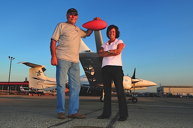

As a former missionary with the Anglican Church, Ruth Charlton knows about life in the Canadian North and its unexpected surprises. A native of Scotland, she arrived in Canada in 2001 and found herself stationed for two years in Kugluktuk (formerly Coppermine), a hamlet located at the mouth of the Coppermine River in the Kitikmeot Region of Nunavut. It is the territory’s most westerly community and lies very close to the Northwest Territories border. It was in this unlikely place that she met her future husband, John Charlton, a geophysicist who was in the area working on an aerial survey in 2002.
The two of them got together a year later and in 2004 decided to launch their own survey company: Tundra Airborne Surveys Ltd. (TAS). Over the span of his 38-year career, John has conducted numerous ground and aerial surveys for a variety of mining companies; but ironically, he’s never been a fan of flying. That’s where Ruth comes in. Until she met John, Ruth knew nothing about aerial surveying but discovered that she loved to fly. With training, she became comfortable operating the digital survey equipment in the aircraft.
When TAS was in its infancy, survey contracts were secured using John’s contacts and the couple would rent a Beechcraft King Air, modified with a tail boom and wing tip pods, to complete the work.
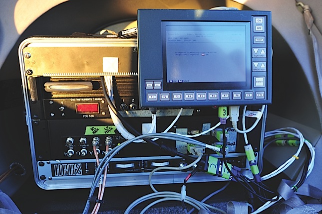
“Initially, when I was in the King Air, I was in the back,” Ruth told Canadian Skies. “I made sure the navigation system was working and that it was supported properly. I made sure everything was working with the magnetometers and digital recording equipment. Once everything was up and running, I would sew teddy bears to pass the time.” An avid sewer, Ruth laughed at the memory. “I knew it was getting too turbulent and the data was getting compromised when I couldn’t thread my needle any more. I would tell the pilot it was time to go back.”
John, meanwhile, was back on the ground analyzing data from the aircraft and packaging it for TAS clients. He is also the official flight follower, tracking the location and path of the survey aircraft to ensure its whereabouts are monitored at all times.
The aerial survey business was booming back in 2004. Markets were flying high and the demand for resources triggered a need for geophysical data and exploration. Multiple northern surveys were launched in the hopes of finding kimberlite formations (diamonds), uranium, nickel, oil and gas deposits and other precious metals. TAS was in the right place at the right time, providing fixed-wing magnetic and radiometric aerial surveying services.
“Times were good. We worked six months straight for four years,” said John. “You’re trying to fly as much as you can. It’s better to fly in the Arctic in the summer, because of the longer daylight hours. Summer is the best time to fly, but there are companies that work all year round.”
Launching a Star
In the summer of 2005, the Charltons were in Churchill, Man., completing a survey with a leased King Air. During a break at the FBO, their pilot showed them a magazine article about Diamond Aircraft’s DA42 Twin Star.
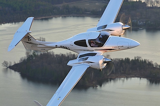
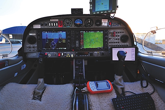
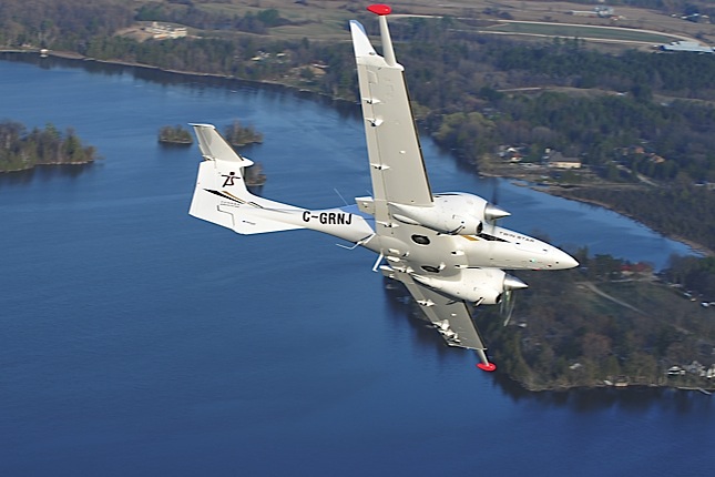
“He said we should be using that aircraft instead,” remembered Ruth. “So, after the 2005 summer season, we went to the Diamond Aircraft factory [in London, Ont.] to see the DA42. It didn’t take us long to decide that it was the right aircraft for us. It was designed for surveillance and it’s particularly well suited for survey work, staying in the air for long periods [a maximum of 5.5 hours with the pilot and Ruth on board] and using relatively little fuel.” TAS ordered a DA42 Twin Star in January 2006.
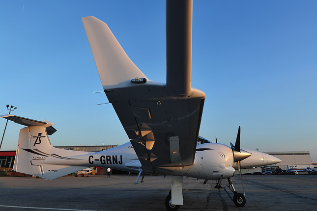
The aircraft was delivered in July 2007, but it still had to be modified with the installation of a nose stinger and wingtip pods, each holding a magnetometer to facilitate surveying. The modification firm the Charltons hired said the work would take six months, with the aircraft ready to fly for the 2008 spring survey season. But the couple found themselves facing one delay after another, with the end result being that their DA42 was parked for more than three frustrating years – during which time they still had to lease other aircraft while making payments on a machine that wasn’t bringing in any revenue.
Around the same time, markets tanked. Prices were down and business was excruciatingly slow. TAS managed to survive, with John and Ruth taking work where they could find it. In 2009, Ruth went to work for a helicopter survey company, while John leased a Piper Navajo to complete a contract in the Alberta foothills. In the same year, the Charltons cut ties with the slow-moving aircraft modification firm, which had completed the removable nose for the DA42, but they still had to wait for a limited supplemental type certificate (LSTC) to certify the nose design. As for the wingtip pods, they were built and installed in six months by another provider, and then wiring was installed to accommodate the new navigation and computer screens.
“The plane was finally ready to work in October 2010, but it was late in the season and there was no work around,” remembered John. “The plane went to Bill Welsh at the Diamond Flight Centre in London, Ont., who was looking for a twin trainer. We leased the aircraft to him; we operate under their operating certificate and they provide us with pilots [to fly the aerial surveys].”
Flying a Grid
Aerial survey pilots need special training. Flying a precise grid pattern, sometimes as low as 150 feet above the ground, takes practice and skill. “When you consider the terrain, it takes a lot of concentration to stay at the right height and speed, and stay on your grid line,” Ruth said.
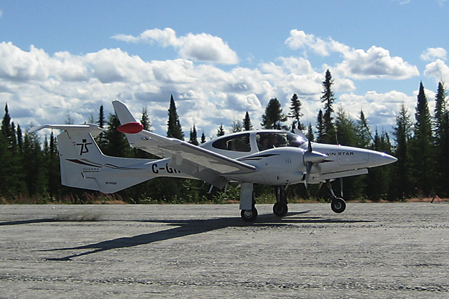
TAS’ DA42 pilot is Dave Brown of the Diamond Flight Centre, who is also a former test pilot for Diamond Aircraft. Ruth did some aerial training with Brown outside of London, and he practised tight turns in the sim, too. Both Brown and the Charltons were ready roll in May 2011, when the DA42 embarked on its first actual paid geological survey, based out of Mirage Lodge in the James Bay region of Northern Quebec. Brown flew the DA42 to the site, while the Charltons followed by car – covering more than 2,000 kilometres during the journey.
Last year was a good year for TAS. In addition to finally launching their DA42 in May, the aerial surveyors also partnered with custom geophysical services company Scott Hogg & Associates Limited of Toronto, in March. Together, the two companies offer helicopter surveying using a self-contained towed bird survey system.
“Most of the work we did in 2011 was helicopter surveying,” said John. “He [Scott Hogg] finds the work and we go do it. He does the data processing and interpretation, and writes the reports. It’s a good partnership.”
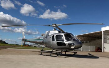
TAS leased a Eurocopter AS350B to tow the three-axis magnetic gradiometer survey bird, which weighs less than 250 pounds and does not require the installation of racks or other helicopter modifications. As always, Ruth rode along with the helicopter pilot as equipment operator.
“Our 2011 season started in March and didn’t finish until late October,” said John. “As for 2012, the business forecast depends on the market. All our work is with junior mining companies who don’t have an existing mine; they are all about the exploration. If they find anything, they will usually make a deal with a major company because they can’t develop it alone.”
Although their business is directly tied to the unpredictable performance of the commodities markets, the Charltons are optimistic about the 2012 survey season. They are thrilled with the performance of their DA42 Twin Star, and said the aircraft was definitely worth the [extended] wait.
“I love it. I love to fly in it; it was the right choice for us,” said Ruth enthusiastically, who is no longer relegated to the back of the plane and now sits beside the pilot. “The aircraft performed perfectly. That was the one thing we were nervous about – each airplane is different, and we weren’t positive what the data would be like from the DA42. But, the data was beautiful and clean. The plane just sips fuel, and it has a big wingspan which is good for the magnetometers–the further apart they are, the better.”
The couple said that compared to a King Air’s fuel burn of about 245 litres per hour, the DA42 uses just 36 litres per hour. Plus, its diesel engines use jet fuel, “and you can’t find avgas anywhere up north,” said John.
When they’re not conducting aerial surveys over the wild Canadian North, the Charltons reside in St. Catharines, Ont. The couple loves to spend time at a beach house in Brazil; eventually, it’s their plan to spend the Canadian winters there.
“We figure we’ll do this for another five years, ride the wave, then maybe hire staff to go out with the DA42 and do the surveys,” said John. Instead of hunting for diamonds in the Canadian North, the couple is looking forward to combing a Brazilian beach for buried treasure.