Estimated reading time 6 minutes, 39 seconds.
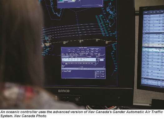
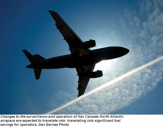
Three major changes to the surveillance and operation of North Atlantic airspace are underway at Nav Canada. The adjustments being made in the Gander oceanic control area incorporate state-of-the-art technology that will increase Nav Canada’s surveillance of oceanic airspace, translating into significant fuel savings for operators.
EXTENDED REACH
First, Nav Canada will introduce the Gander Oceanic Transition Area (GOTA) on May 29, 2014, a change that will see oceanic entry points moved 185 nautical miles farther east over the Atlantic Ocean. This will provide aircraft with an additional 20 to 25 minutes of flying time with the type of benefits they would have in domestic airspace. By increasing their stay in surveilled airspace, pilots will have the advantage of direct controller communications, which will mean higher, quicker, and more direct routes for their flights—translating into reduced fuel consumption for operators.
“These aircraft can start getting on their way to their destinations much sooner,” explained Chris Mouland, Nav Canada’s general manager for the Gander flight information region. “Because they’re under surveillance no different than they are over most territorial Canadian airspace, it allows us to do the same things we do elsewhere in Canadian skies.”
The extended surveillance range is made possible by eight strategically placed automatic dependent surveillance- broadcast (ADS-B) stations along Canada’s northeast coast and the southern tip of Greenland. Mouland said the technology has a very high degree of reliability, and is significantly less expensive to install than alternative surveillance equipment.
While aircraft are in monitored airspace, air traffic controllers can move them closer together and increase their flying altitudes, therefore creating a window of opportunity for flights at lower altitudes to rise to fill the vacant spaces.
“Aircraft can change altitude much quicker because the [spacing] standards will drop from 10 minutes in many cases, down to 10 nautical miles,” Mouland told Skies.
“[The current spacing of] 10 minutes for two jets in a westbound operation is about 80 nautical miles, and you’re now able to go down to 10 nautical miles.”
MAKING TRACKS
The next change sees Nav Canada examining opportunities to move aircraft closer together laterally, creating extra space for new tracks to be formed on high traffic routes.
“This has allowed us to peek well into the North Atlantic airspace […] and we’re aligning the fixed structures—the fixes—these are geographic points on the map, and that will move us into our next phase of lateral spacing, referred to as Reduced Lateral Separation Minima,” explained Mouland.
Reduced Lateral Separation Minima, or RLatSM, is on pace for introduction in the fall of 2015. The program will reduce lateral spacing between flights on the North Atlantic from the standard 60 nautical miles, which is equal to one degree of latitude, down to 30 nautical miles. The result will eventually be “like adding another lane on Highway 401,” explained Nav Canada’s manager of media relations, Ron Singer.
Mouland added that RLatSM will be phased in slowly, and will initially be introduced on only three tracks. As part of Nav Canada’s safety management approach, an incremental roll-out will allow the air navigation services provider to analyze data and assess the safety of the program before releasing it on more routes. Mouland predicts that over a three-to-four-year period, all North Atlantic routes could be transformed into 30 nautical mile tracks, or half degree separation scenarios.
HIGHER SAVINGS
The last Nav Canada program that’s translating into fuel savings for operators is a software enhancement to the Gander Automatic Air Traffic System (GAATS) called the Gander Oceanic Flight Level Initiative (Gofli), which encourages pilots to climb to a higher altitude when possible. As soon as a westbound trans-Atlantic flight crosses into Nav Canada controlled airspace, Gofli—which is already in operation— tracks when it climbs to higher altitudes and leaves a vacancy for an aircraft at a lower altitude to fill. The system will then send air traffic controllers a message to alert them of the available altitude, which the controller will pass on to a lower flying pilot, thus reducing the need for pilots to actively request higher altitudes from air traffic control.
“Gofli addresses a bit of a problem that we were made aware of over the last couple of years,” said Mouland. “Pilots that tend to keep being told that things are not available sort of lock into that mentality, and say ‘I’m not going to ask; I’ll never get it.’ There are opportunities for climbs of course; when one aircraft climbs, it vacates an altitude, and another aircraft may climb. Our system is a proactive approach to this.”
Between Dec. 8, 2013, and Jan. 11, 2014, Nav Canada controllers offered pilots 5,142 climbs, and 1,271 aircraft accepted. Mouland said that considering the system was only released in November 2013, the results are impressive, and he only expects them to improve as pilots become more educated about the initiative.
“Our mandate is service delivery,” he said. “It’s all about providing the best service to the customer at the least cost, and using the most efficient means of doing that. Every little bit of this has a very significant impact on the environment and fuel savings for our customers, and that’s really what it’s all about for us.”