Estimated reading time 7 minutes, 12 seconds.
Initially created to provide intelligence, surveillance, and reconnaissance solutions for the military, drone technology has had difficulty transitioning to commercial use. Military drones are not well-suited to interact with civilian aircraft and consumer models do not have the necessary range or technology.
Alberta-based Pegasus Imagery believes it has bridged the technology gap between military and consumer applications. The company provides real-time intelligence and data solutions at scale to the emergency management, public safety and energy sectors.
Owner Cole Rosentreter became an entrepreneur after a parachuting accident cut his decorated 15-year military service short. A paratrooper with the Princess Patricia’s Canadian Light Infantry (PPCLI) he actively served on several deployments, including three in Afghanistan. During his tours, he witnessed how drone technology was able to help soldiers work safer, smarter and more effectively.
“It was a natural choice to make my next mission to support the guys on the front lines here at home,” he said.
Bridging the tech gap
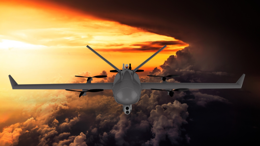
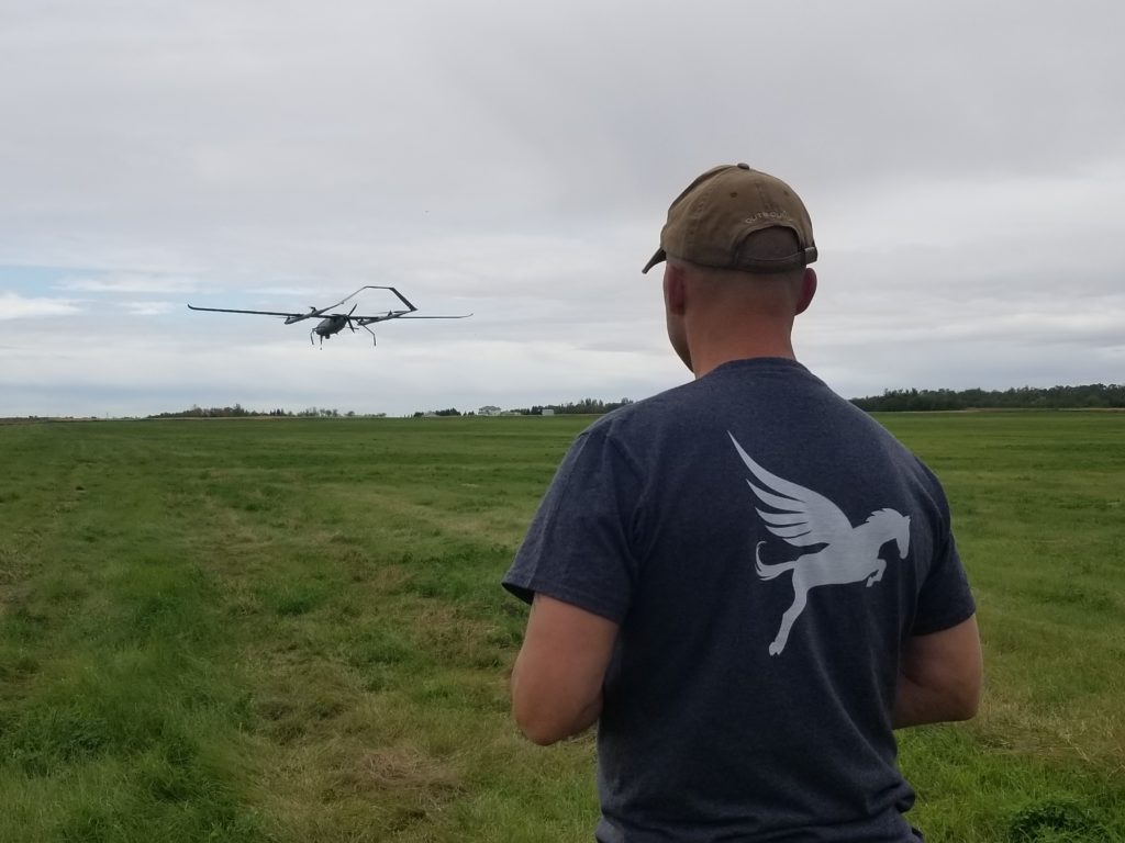
Hyperion, the company’s long-range drone, was designed to deliver continual airspace awareness during flight and to deliver these solutions at scale. It is based on two prototypes used in commercial contracts earlier this year for the Alberta government, law enforcement, conservation and the energy sector.
The aircraft is capable of carrying multiple sensors on a single flight, including connected voice and data comms. In addition to its ability to supply thermal imaging and aerial mapping, it is equipped with military-grade sensors and communications equipment, able to capture and deliver real-time electro-optical and infrared video through a secure connection.
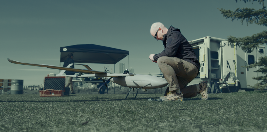
“We build our own drones to meet the needs of the market. All of our aircraft are manufactured in Canada and use only components and technology developed in North America,” said Rosentreter, explaining the company’s commitment to information security. The first of these drones are already in the manufacturing stage of development.
Timing is everything
Transport Canada’s June 2019 release of its remotely piloted aircraft systems (RPAS) regulations were serendipitous for the company and provided a road map for the integration of drones into the national airspace system. Pegasus Imagery has identified benchmarks and critical areas of interest that it needs to be able to fly beyond visual line of sight (BLVOS) in Canada. This ability is required for the pilots to collect data at scale.
Pegasus holds a unique special flight operations certificate from Transport Canada authorizing operations up to 2,000 ft in all restricted airspace across Canada. Pegasus is also working with Transport Canada and early adopters on BVLOS trials in uncontrolled airspace starting in 2020.
Since relocating to the Edmonton International Airport last March, the airport authority has become a close partner, helping the company to transition from aircraft development into the trials and beyond.
Partnering with commercial aviation
The Helicopter Association of Canada expects to see a net loss of 7,000 pilots by 2035. With personnel shortages looming, drones can free up pilots to work where they are most needed.
“We are not here to replace jobs; we are here to make jobs more efficient for the people doing them. It’s about playing to everyone’s strengths. We excel at persistent monitoring and information sharing that enables manned aviation to fly more.
“For example, in a wildfire situation, drones can gather data 24 hours a day from above the fire and not put pilots in danger. Very few aircraft fly at night near a wildfire, and the night shift is a natural place to start filling that information void. We’re going to see this transition to daytime use as well. By flying a few thousand feet higher than the helicopters, bird dogs, and waterbombers, the real-time information provided allows those pilots to respond where they are needed most,” explained Rosentreter.
Drones are also well suited to detecting fires over large areas of land within minutes. “When you look at the root cause of wildfires, you see that from the time a fire starts to when it is detected can be anywhere from minutes to days,” Rosentreter continued.
Alberta has 127 lookout towers for fire detection, it is a massive infrastructure and personnel investment. Officers look for smoke on the horizon, but often by the time a fire is big enough to do that, it is too large to be put out by a single helicopter team. The length of time between fire detection and the point where it can no longer be actively engaged and suppressed can be very short.
“Unmanned aircraft can operate 24-7 at scale to detect a fire in minutes allowing for the immediate deployment of the best resources,” he further explained. Additionally, after a fire, drones are also able to offer 3D mapping of the affected areas to assist with recovery methods.
Rosentreter is passionate about the service Pegasus Imagery is providing. “First responders have the mission of keeping our communities, environment and economy safe here at home. We can provide the tools to assist them. Their mission is really our mission.”
Tania Moffat is a freelance writer, editor, publisher and photographer. She has worked in the publishing industry for the last 15 years on a wide variety of B2B and consumer publications, she can be reached at info@chiccountrylife.com.
Ho quel beau projet et excellente réalisation
j’aimerais avoir plus d,info de la Compagnie
et aimerais faire la visite de l’entreprise
Bonjour
j’aimerais avoir plus d’info, faire une visite de la compagnie,
de l’aéronef.
Yvon G.
Bonjour Yvon,
Vous pouvez contacter Pegasus Imagery ici: https://www.pegasusimagery.ca/
Merci.