Estimated reading time 3 minutes, 44 seconds.
In-Flight Data has received a one-year special flight operations certificate (SFOC) allowing the company to conduct repeated drone flights beyond visual line of sight (BVLOS).
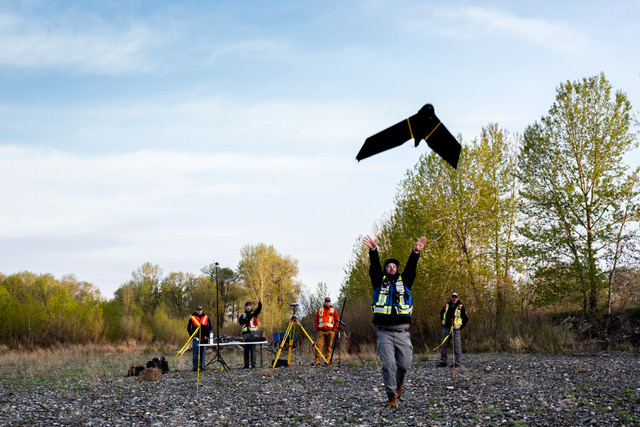
With a flawless safety record, In-Flight Data has been a Canadian leader in pushing the envelope for safe, extended-range flight. The new Transport Canada approval opens the opportunity for ongoing, repeated BVLOS flights on behalf of In-Flight Data’s clients.
“I’m thrilled with the Transport Canada approval,” said In-Flight chief executive officer Chris Healy. “I cannot tell you how happy this makes me, nor how proud I am of our team. This is definitely a lifetime career highlight for everyone.”
In Canada, drones — known officially as remotely piloted aircraft systems or RPAS — are regulated by Transport Canada. The federal agency tries to strike a sound balance between encouraging innovation and entrepreneurialism — and the safety of both manned aircraft and people on the ground. As the rules currently stand, all BVLOS RPAS flights require special permission from Transport Canada.
To obtain that permission, the agency must be satisfied the operator is flying safe equipment and is qualified — including having a deep understanding of airspace law and traffic in Canada. In addition, Transport Canada examined In-Flight Data’s standard operating procedures, emergency protocols, training and track record before determining that the company merited approval for ongoing BVLOS flights.
“I won’t kid you: This was a long and very detailed process,” said Healy. “But Transport Canada takes these applications very seriously — as it should. We’re so pleased to be one of the very few in the country to have cleared this very high bar.”
The SFOC means that In-Flight Data can now fly well beyond the range that can be seen by the pilot’s naked eye in all regions of Canada, day or night, above or below 400-feet above ground level BVLOS for public safety and until the summer of 2021.
This opens the door for long-range data acquisition on behalf of clients, including the ability to use cameras and other sensors to monitor long-range assets such as pipelines, power lines, and even coastlines. Such flights can also be used for complex 3D missions where the area of interest is scanned by laser using LiDAR — or light detection and ranging. RPAS can be deployed for search and rescue missions, oil leak detection, mapping, and even the delivery of critical medical supplies.
“Receiving this SFOC approval is more than just a validation of how we carry out business,” added Healy. “It also greatly expands the kinds of business In-Flight can carry out, as well as where and when these missions can take place. We look forward to a gathering a greater variety of data, over greater distances and for more clients, than ever before.”
In addition to being an RPAS pioneer in Canada, Healy serves on Transport Canada’s Remote Traffic Management Action Team, helping to shape the framework for safely integrating manned and unmanned aircraft in Canadian airspace. A project management specialist, Healy is also the chair of the RTM National RPAS Operators Group, representing the interests of drone operators across Canada to Transport Canada.
