Estimated reading time 20 minutes, 18 seconds.
In October 2015, aviation history was made in northern Sweden when Örnsköldsvik Airport became the world’s first remotely controlled airport managed by a controller at a workstation 140 kilometers (87 miles) away at the Sundsvall remote tower center.
The brick-and-mortar air traffic control (ATC) tower has been an iconic airport landmark since the world’s first tower opened at Croydon Airport near London, England, in early 1920. The concept of using a tower or elevated structure to provide an out-the-window view to manage air traffic at airports has remained largely unchanged for the past 100 years.
During the past seven years, however, a new paradigm in airport air traffic services (ATS) has started to take root. This is known as the “remote tower” or “digital tower” concept invented by the German Aerospace Center (DLR) in 2002. The concept uses optical sensors, microphones, video screens, and other digital technology to allow ATS operators to provide safe and efficient service from a location independent from the airport site.
Today, more than 80 airports in more than 30 countries have some form of digital ATS in operation, under development, or in feasibility study, with about 20 sites already approved to manage day-to-day aircraft movements remotely, according to air traffic management (ATM) consultants from Think Research.
In the coming decades, more air navigation service providers (ANSPs) are expected to adopt this digital ATS approach to enhance service and safety, manage future air traffic growth, replace aging infrastructure and technology, reduce costs, and attract a new workforce to the ANS profession.
In early 2022, Nav Canada put its hat into the ring when its new strategic direction identified digital facilities as one of three revolutionary technologies (along with space-based surveillance and gate-to-gate flight management) that will transform how airspace users safely transit Canadian skies in the coming decades.
The first public milestone occurred in mid-January 2023, when Nav Canada announced that it had selected Kingston Airport in Ontario as the site for its first digital facility under its Digital Aerodrome Air Traffic Services (DAATS) program — customized for Canada’s unique geographic and aviation landscape.
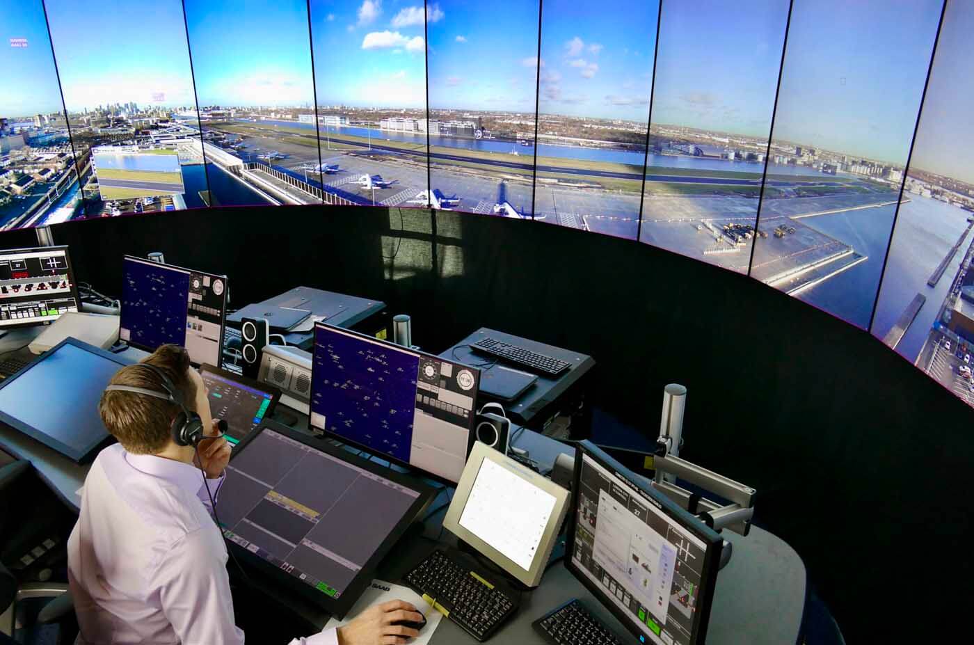
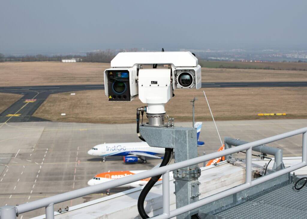
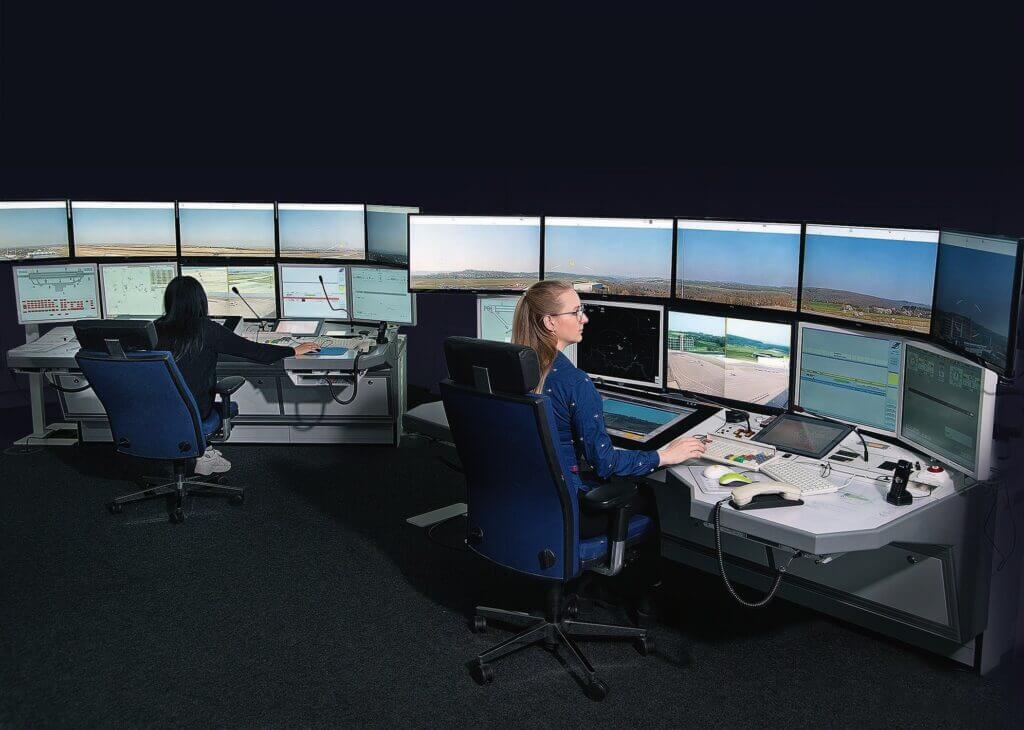
The primary difference when compared to a traditional ATC tower or flight service station building is that ATS professionals no longer have an out-the-window view. Instead, they utilize a digital technology solution with high-resolution optical sensors, external microphones, and other sensor technology to capture what is happening at an airport in real time.
The live video and data feed, transmitted through secure, reliable networks, is used to provide a visual presentation of airport activity on a set of large video screens that provide ATS operators with a digital presentation of airport activity. This solution allows ANSPs to provide the same (or improved) level of service to airspace users.
“Digital facilities provide an opportunity to re-imagine how we deliver service, and where we deliver it from, allowing Nav Canada to respond effectively and efficiently to changes in airport traffic demand,” said Mark Cooper, vice president and chief technology and information officer, in a press release.
“Nav Canada will leverage technology to continue to provide safe and efficient service levels, increasing resiliency and supporting the aviation industry’s sustainability recovery targets,” he added.
The DAATS program will begin with the testing and validation of the technology and operating concepts required for a single digital facility serving Kingston Airport. This work will lay the foundation for the creation of a DAATS hub concept aiming to prove centralized ATS to multiple airports in about four to six years’ time.
Nav Canada’s long-term vision is to deploy DAATS hubs in different regions that will incrementally transform how ATC, airport advisory services and remote aerodrome advisory service are delivered at airports across Canada over the next 15 to 20 years.
Canada’s ANSP does not plan to change the level of service provided by air traffic controllers and flight service specialists to airports and airspace users today.
Digital ATS Transformation
The “remote” or “digital” ATS concept started taking shape in 2005 when the world’s first remotely controlled tower prototype was established in Germany by the DLR Institute of Flight Guidance at Braunschweig Wolfsburg Airport to test technical and operational feasibility.
The European air traffic control infrastructure modernization program, known as Single European Sky ATM Research (SESAR), soon backed the concept, with Swedish ATC provider LFV and German ATC provider DFS showing the first interest.
Then, several leading international agencies stepped forward to help develop supporting standards and guidance materials, including the European Organization for Civil Aviation Equipment, the European Union Aviation Safety Agency, the International Civil Aviation Organization, and Civil Air Navigation Services Organization.
This included further development of the remote tower center concept where one site provides ATS to multiple airports. One of the advantages of pooling ATS professionals together at the same location is that an ANSP can be more responsive to changes in air traffic demand and balance employee workloads, all while fostering a culture of innovation in a modern workplace.
Sweden
The first operational deployment took place in Sweden when LFV and airport operator Swedavia sought a cost-effective and resourceful way to upgrade ATS at remote airports that had limited scheduled airline service.
In place of a traditional tower, LFV formed a strategic partnership with Saab (formerly Saab Digital Air Traffic Solutions) to install a 10-meter (33-foot) mast at Örnsköldsvik Airport, topped with a cluster of optical sensors and microphones. The real-time video and sensor data was transmitted by fiber-optic cable to Sundsvall, where a controller seated in front of a large semi-circular visual display had a digital view of the airport’s 2,014-m (6,607-ft) runway, as well as the apron and surrounding area.
This first digital tower implementation took over five years of planning and testing until it was certified. Sundsvall then became the world’s first digital hub when the remote tower center started managing air traffic to three additional airports: Sundsvall-Timrå Airport, Linköping City Airport, and Sälen Trysil Airport.
Since then, LFV opened a second remote tower center in Stockholm in June 2021 to provide remote ATS to four additional sites: Kiruna Airport, Umeå Airport, Åre Östersund Airport, and Malmö Airport.
Germany
Germany was the next country to introduce the concept when DFS decided to manage traffic at Saarbrücken Airport from a new remote tower center built 450 km (280 mi) away in Leipzig. The system uses technology developed by the Austrian company Frequentis and was certified for operations in December 2018.
In Leipzig, the standard ATC systems used by a controller are complemented by out-the-window 360-degree and 190-degree visual presentations. The sensor package includes infrared sensors that improve situational awareness at night and in inclement weather, as well as pan-tilt-zoom cameras that can follow objects like automatic binoculars.
The remote tower center now manages Saarbrücken and Erfurt-Weimar airports utilizing controllers from these airports who relocated to the Leipzig hub. This year, service is to be expanded to Dresden Airport.
In a separate development, the Saab digital remote tower installed at NATO Air Base Geilenkirchen was declared operational in September 2022. The base is home to NATO’s fleet of Boeing E-3A airborne early warning and control aircraft.
Norway
In the late 1960s, Norway initiated the construction of a large network of short takeoff and landing airports at small communities along its rugged coast to support the introduction of Widerøes Flyveselskap’s new fleet of Canadian-built DHC-6 Twin Otter turboprops.
Aerodrome Flight Information Service facilities were established at many of these remote airports, but after 40 and 50 years of service, many of the towers required major refurbishment or total replacement.
The replacement challenge prompted the Norwegian state airport operator Avinor to team up with two technology companies — Kongsberg Defence & Aerospace and Indra — to develop and install a network of digital towers and integrated ATM systems to save on reconstruction costs. This would also bring its far-flung staff together at a modern remote tower center in the arctic town of Bodø.
Remote operations first began at Røst Airport in 2019, with each remote airport equipped with a Kongsberg 360-degree Camera System on a rotating platform that incorporates two cameras — a line scan camera for visual light and a line scan camera for long wave infrared light.
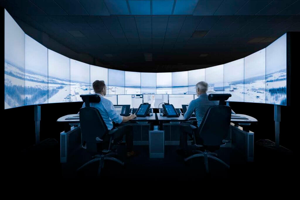
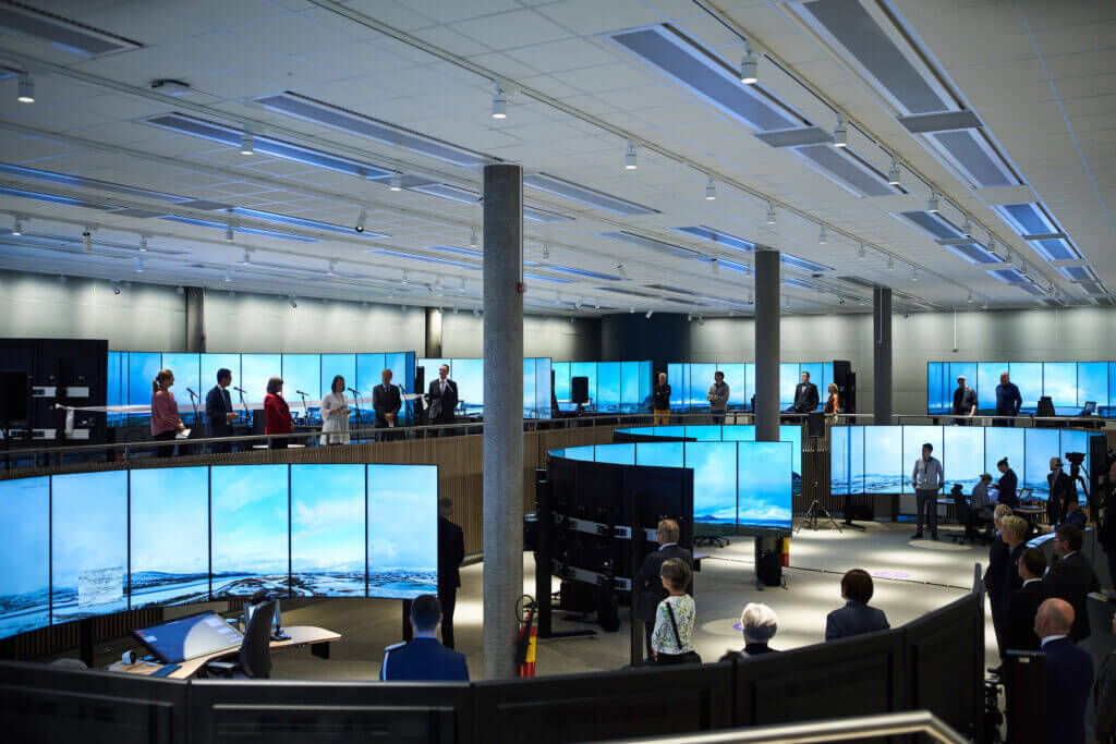
The original remote tower center was located in a renovated section of the Bodø Airport passenger terminal. Later, on June 1, 2022, Avinor officially opened the world’s largest remote tower center in Bodø, with the most impressive architectural feature of the modern facility being 15 panoramic video walls in front of workstations — each one providing a visual presentation of a different airport.
The standard operating mode in Bodø is a single aerodrome flight information service officer (AFISO) paired with a single airport. However, Avinor has been working closely with its operational staff and the Norwegian Civil Aviation Authority (CAA) to develop sequential and multi-operating modes to serve low-traffic airports.
In late 2022, the Norwegian CAA approved “advanced sequential operations,” which permits an AFISO to operate two airport towers during one shift from the same working position — during times when there are no simultaneous aircraft movements. In the future, the Norwegian CAA approval of the multiple operations mode will allow Avinor staff to operate multiple airports with low-traffic volumes simultaneously.
United Kingdom
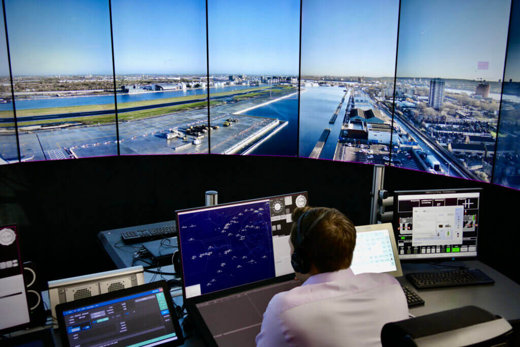
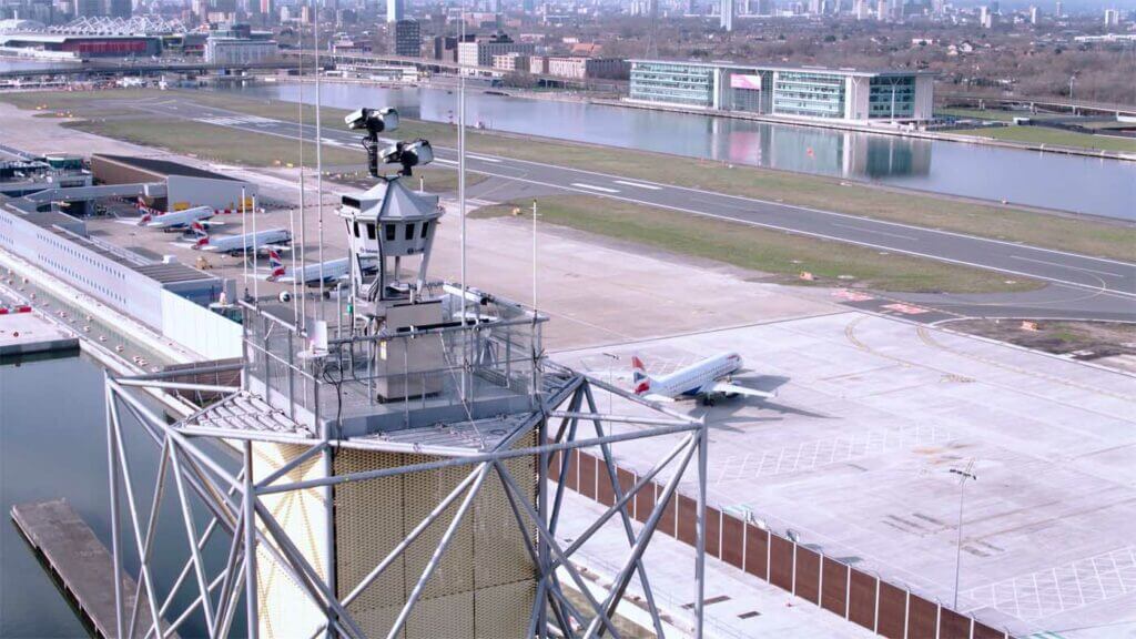
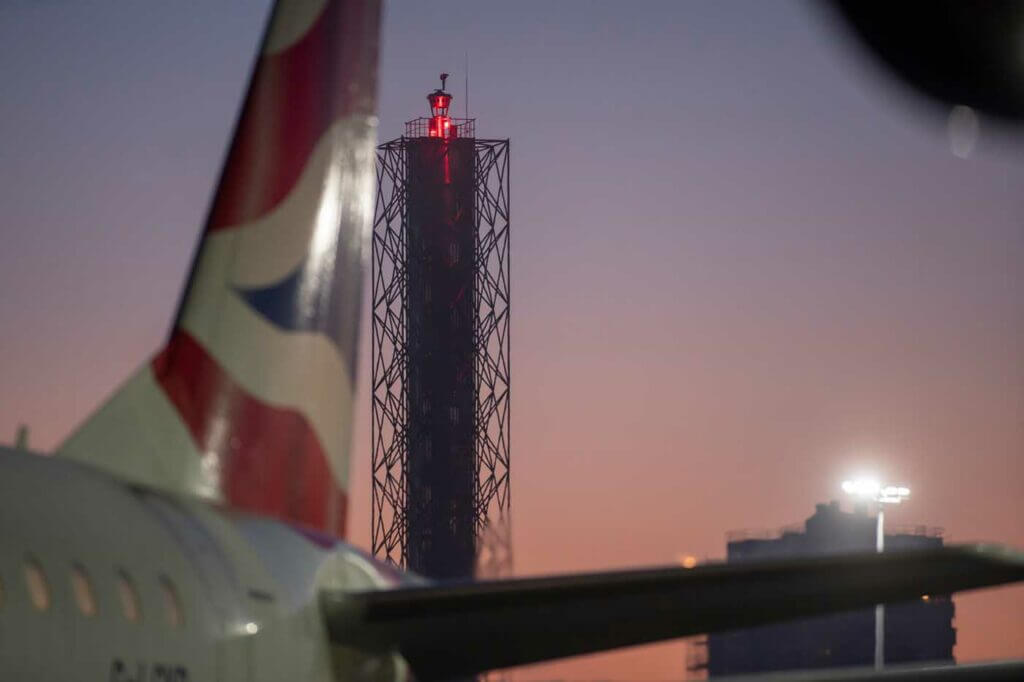
In April 2021, London City Airport in the U.K. announced it had become the first major international airport in the world to be fully controlled by a remote digital ATC tower.
The airport is located 9.7 km (6 mi) east of the City of London on a quay in the Royal Docks area and has a single runway — which handled 90,000 movements and five million passengers in 2019.
Rather than replacing the airport’s 30-year-old analog tower, which was due for a significant upgrade, the U.K.’s ATC provider NATS contracted Saab to install a state-of-the-art, 50-m (164-ft) digital control tower at the airport. It features 16 high-definition cameras and sensors mounted on the mast, capturing a 360-degree view of the airport.
The data is relayed through three secure fiber-optic cables to a new control room in NATS’ ATC center, located 115 km (71 mi) to the south-west in Swanwick, Hampshire. The video is displayed on 14 high-definition screens to provide a panoramic view of the airport, and the screens can overlap with digital data to provide an enhanced-reality view of details like the call signs, altitude, and speed of aircraft approaching and leaving the airport.
Operations switched from the digital facility following intensive testing and live trials of the revolutionary technology during the Covid-19 pandemic.
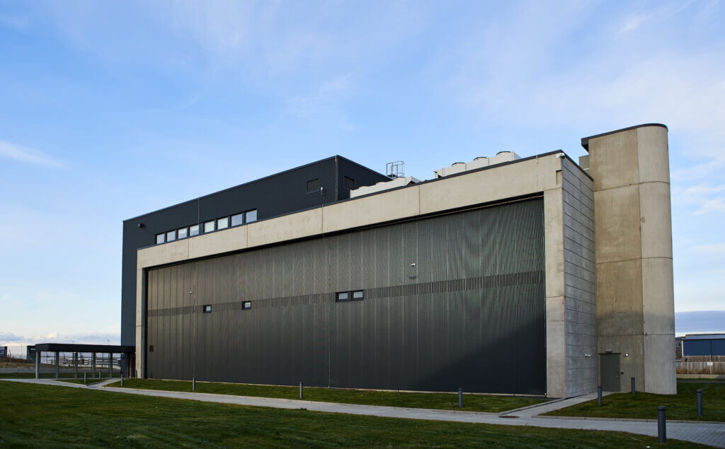
Five other airports in the U.K. have digital facilities, including two military bases. In 2009, London Heathrow Airport also introduced the world’s first Virtual Contingency Facility (VCF) installed by Searidge Technologies in a windowless building. It is equipped with video screens that can be used to manage flights if there is a serious problem or maintenance work taking place at the airport’s main control tower.
European ANSPs were the first to adopt the technology, but it is also being introduced in various forms in Abu Dhabi, Argentina, Australia, Azerbaijan, Belgium, China, Dubai, Hong Kong, Iceland, India, Malta, New Zealand, Singapore, the United States and, of course, Canada.
Nav Canada
Transport Canada, together with the Department of National Defence, provided all air navigation services since a requirement for ATC at airports was recognized in 1938, following the creation of the Department of Transport (now Transport Canada) in 1936, and the completion of the Trans-Canada Airway network of coast-to-coast airports.
The first course for 10 air traffic controllers commenced in 1939 to staff Saint-Hubert, Winnipeg, Edmonton, and Vancouver airports — which were the busiest airports in Canada at the time.
The Montreal Saint-Hubert Airport control tower was commissioned in 1939, followed by Malton (now Toronto Pearson), Ottawa, and Vancouver airports in 1940; Edmonton and Winnipeg airports in 1941; and Dorval (now Montreal-Trudeau) Airport in 1942.
In the subsequent years, iconic towers were built and rebuilt at many Canadian airports and flight service stations established at other airports to provide pilots with airport advisory services.
In 1996, Canada became the first country in the world to fully privatize its civil air navigation system when it was sold to Nav Canada for $1.5 billion, taking over a unique and critical role managing the 18 million square km of Canadian civil airspace and the North Atlantic oceanic airspace under Canada’s control.
Since then, Nav Canada has invested more than $2.6 billion in the air navigation system, developing and deploying advanced ATM and surveillance tools that have led to significant improvements in safety, efficiency, capacity, resiliency, and sustainability.
DAATS Implementation
Thirteen years ago, Nav Canada became a pioneer when it started using video camera technology developed by Searidge Technologies at several airports across the country to plug gaps where the ATS professionals did not have a clear out-the-window view within the airport maneuvering area or nearby airspace.
Its DAATS, or Digital Aerodrome Air Traffic Services, program leverages previous learning experience, providing after-hours airport advisory services at Fredericton International Airport (CYFC) remotely from Saint John, New Brunswick (CYSJ).
In 2020, optical sensors installed at Fredericton Airport were integrated into a workstation at the Saint John flight service station to demonstrate how digital technology can improve situational awareness. Working with Transport Canada, the facility was operational between 2021 and 2023 and provided Nav Canada with extensive operational and technology experience utilizing digital ATS technology.
Additionally, a three-year technology project at Red Deer Airport (CYQF) in Alberta that ended in 2022 saw the installation of 46 optical sensors mounted on four masts at key locations at the airport. Though the technology was never used to manage flights, it provided valuable insights regarding sensor positioning and integration.
When the DAATS project team was formed in early 2022, one of the first tasks was to analyze a suitable location for the first digital facility under the program. After extensive analysis, Kingston Airport (CYGK) was selected.
The switch to the digital facility in Kingston will only take place after a thorough verification and validation process leading to Transport Canada concurrence. Then, Nav Canada will repeat the whole process again when a second airport in another community is selected to validate the remote aspects of the ATS technology and operating model, before a hub is developed.
Nav Canada is not moving forward with this project alone. In late January 2023, it issued a Request for Proposal to select a technology partner for the DAATS program. That vendor, once selected, will determine the type of sensor technology that is to be installed at airports and at the eventual hub.
Once the systems are installed, there will be extensive technology training, testing, human factors and operational validations, safety assessments, and other evaluations at the digital facility by Nav Canada employees and the vendor.

To recap how the digital tower technology works, high-resolution optical sensors, microphones, and other sensors are installed on masts or structures to capture what is happening at an airfield. Such sensors have the ability to magnify images and track aircraft in the air and on the ground, as well as airport vehicles and wildlife that could pose a hazard. Some optical sensors even incorporate advanced infrared sensor technology that enhances situational awareness at an airport during inclement weather conditions, low visibility, and variable light conditions.
The live video and data feeds are transmitted through secure data networks to the DAATS hub and are displayed on a large set of integrated high-definition video screens or monitors that provide an immersive visual presentation of the airfield and surrounding area.
These screens or monitors — along with the other technology that is typical of an ATC tower or flight service station — provide ATS professionals at their workstations with the appropriate visual representation required to safely manage the air traffic movements on and around an airport.
While Nav Canada fully understands that the key to success is effective change management and communications, it is necessary for the ANSP to work closely with the internal and external stakeholders that will be impacted by the change.
It took 90 years for Canada to develop the current brick-and-mortar air navigation service infrastructure that serves airspace users and airports today. As Nav Canada ushers in a new era that will see the implementation of digital air traffic services, safety remains the highest priority.
I think it’s great. The same thing will happen in the cockpit with the new satellite abilities to transmit data, the copilot will become remote and look after 2/3 flights.
I think this is a disaster waiting to happen, air traffic control crews looking into screens. Maybe with the right design and setup it might stop rain from obstructing the view, but I think the towers’ slanted windows did that. If something goes down or is hacked, there can be no way to see out. In one photo, there is a colour difference at the edges of two screens, I’m sure that can throw someone off. Same with doing this to airplanes in place of flight deck windscreens as mentioned in a message, not a good idea, wipers may still be needed, tiny for lenses where cameras might be used but still there and wiping. And more electronics to run those screens, cameras and whatever else gives the images, it’s a nightmare how much wiring and electrical components are in airplanes now, including for seatback screens. My hope is where there are people operating, they continue to have a real way to see out, where there are plans for no longer people operated, we’ll have a better choice to avoid that and have people continue guiding our way even where glass and wipers passing by are it. Crews running ATC and flights have too little time to mess with blackened or messed up screens. Many airplanes and pilots do have instrument only flight capabilities, however, the surprise of the view suddenly gone of messed with may cause troubles before taking command by instruments only, especially for new pilots. I think the loss of real gauge instrumentation is not a good idea already for all the reasons mentioned above. Lose one old-school gauge to mechanical failure and there’s another just like it on the other side with all the rest on both sides still working fine. And these gauges can’t be hacked mid flight, they all work or the flight gets delayed for repairs or another airplane gets used.
I don’t agree using cameras and screens. Computer glitch, failure etc.
Better in person in my opinion. How about the lag between the camera and monitor?